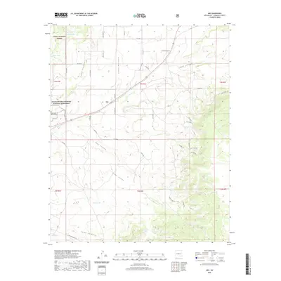
2020 Map of Abo
USGS Topo · Published 2020About this map
Abo State Monument and the surrounding Salinas Pueblo Missions National Monument anchor this high-desert landscape in Torrance County. The terrain is deeply inscribed by a network of drainage systems, most notably Abo Arroyo, which is flanked by dramatic landforms such as Cañon Espinoso and Cañon Barranco. This area, managed in part within the Cibola National Forest, shows a complex intersection of ancient history and modern infrastructure, where the Old Abo Trl and various ranch roads like Valentine Ranch Rd navigate a territory defined by seasonal water sources. The importance of water in this arid environment is evident from the numerous named tanks and springs, including Gun Spring, Wildcat Spring, and Chilton Tank, which serve as vital landmarks across the canyons.
Find a feature on this map
53 named features on this map. Tap any name to fly to it.
Don’t see what you’re looking for? This feature index may not catch every label — zoom into the map to look around manually.
Map Details
Editions of this 2020 Abo Map
This is the sole edition of this map. No revisions or reprints were ever made.
Other maps of this area

1917 · Estancia
USGS Topo · 1:125,000

1954 · Torreon
USGS Topo · 1:62,500

1954 · Socorro
USGS Topo · 1:250,000

1956 · Mountainair
USGS Topo · 1:62,500

1958 · Socorro
USGS Topo · 1:250,000

1962 · Socorro
USGS Topo · 1:250,000

1972 · Chupadera
USGS Topo · 1:24,000

1972 · Bigbee Draw
USGS Topo · 1:24,000

1972 · Abo
USGS Topo · 1:24,000
1972 · Scholle
USGS Topo · 1:24,000