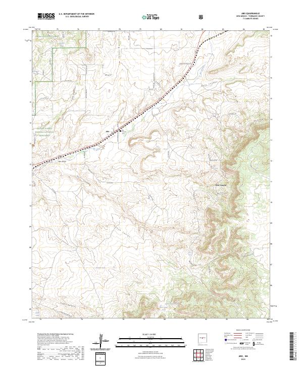
2023 Map of Abo
USGS Topo · Published 2023About this map
Salinas Pueblo Missions National Monument serves as the focal point of this Torrance County landscape, preserving the intersection of ancestral Puebloan and Spanish colonial history. Near the settlement of Abo, the land is defined by a network of drainage systems including Abo Arroyo and Cañon Barranco, which carve through the high-desert terrain. Local genealogists will find the San Lorenzo Cem particularly significant, situated along San Lorenzo Rd north of the main ruins. The area's water management is evident through numerous named stock tanks such as Squatty Tank and Chilton Tank, essential for ranching within the Cibola National Forest. A complex web of contemporary and traditional routes, from the Old Abo Trl to the modern El Paso Gas Pipeline Rd, illustrates the ongoing human passage through these canyons and draws.
Find a feature on this map
51 named features on this map. Tap any name to fly to it.
Don’t see what you’re looking for? This feature index may not catch every label — zoom into the map to look around manually.
Map Details
Editions of this 2023 Abo Map
This is the sole edition of this map. No revisions or reprints were ever made.
Other maps of this area

1917 · Estancia
USGS Topo · 1:125,000

1954 · Torreon
USGS Topo · 1:62,500

1954 · Socorro
USGS Topo · 1:250,000

1956 · Mountainair
USGS Topo · 1:62,500

1958 · Socorro
USGS Topo · 1:250,000

1962 · Socorro
USGS Topo · 1:250,000

1972 · Chupadera
USGS Topo · 1:24,000

1972 · Bigbee Draw
USGS Topo · 1:24,000

1972 · Abo
USGS Topo · 1:24,000
1972 · Scholle
USGS Topo · 1:24,000