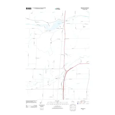
2013 Map of Abrams
USGS Topo · Published 2013About this map
The Oconto River and Machickanee Flowage dominate the northern landscape of this Oconto County region, providing a focal point for the settlement at Stiles. This 2013 survey illustrates the modern transportation corridor where major routes intersect near Abrams, a village situated at the confluence of several vital waterways including the Pensaukee River, Spring Cr, and Brookside Cr. The drainage patterns of the coastal plain are evident through numerous small tributaries like Kirchner Cr and Splinter Cr as they move toward the bay.
Find a feature on this map
70 named features on this map. Tap any name to fly to it.
Don’t see what you’re looking for? This feature index may not catch every label — zoom into the map to look around manually.
Map Details
Editions of this 2013 Abrams Map
This is the sole edition of this map. No revisions or reprints were ever made.
Other maps of this area

1954 · New Franken
USGS Topo · 1:62,500

1954 · Manitowoc
USGS Topo · 1:250,000

1954 · Green Bay
USGS Topo · 1:62,500

1955 · Green Bay
USGS Topo · 1:250,000

1956 · Oconto
USGS Topo · 1:62,500

1956 · Oconto Falls
USGS Topo · 1:62,500

1958 · Manitowoc
USGS Topo · 1:250,000

1974 · Abrams
USGS Topo · 1:24,000
1974 · Lena
USGS Topo · 1:24,000
1974 · Oconto Falls North
USGS Topo · 1:24,000