2017 Map of Absaraka
USGS Topo · Published 2017About this map
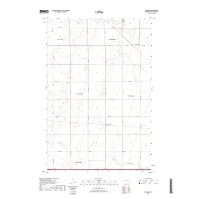
Absaraka serves as the primary settlement center in this portion of Empire Township, where the transition from rural agricultural plots to a structured village is clearly defined by the intersection of Main St and 147th Ave SE. The landscape is dominated by the sprawling drainage of Swan Cr, which meanders across the northern sections of the townships. This 2017 survey by the U.S. Geological Survey illustrates a modern township-and-range grid system, where section lines are strictly followed by a network of local roads such as Co Rd 3 and Co Rd 10. A notable point of local infrastructure is the Punton Private Airport situated near the northern border, while further south, the label for Magnolia indicates a secondary point of interest along the established rural corridors. The map provides a precise look at the land division and hydraulic patterns of central North Dakota.
Find a feature on this map
28 named features on this map. Tap any name to fly to it.
Don’t see what you’re looking for? This feature index may not catch every label — zoom into the map to look around manually.
Map Details
Editions of this 2017 Absaraka Map
This is the sole edition of this map. No revisions or reprints were ever made.
Other maps of this area

1895 · Casselton
USGS Topo · 1:125,000

1897 · Tower
USGS Topo · 1:125,000

1897 · Casselton
USGS Topo · 1:125,000

1952 · Grand Forks
USGS Topo · 1:250,000

1953 · Fargo
USGS Topo · 1:250,000

1956 · Fargo
USGS Topo · 1:250,000

1956 · Grand Forks
USGS Topo · 1:250,000

1965 · Alice
USGS Topo · 1:24,000

1966 · Grand Forks
USGS Topo · 1:250,000

1967 · Page SE
USGS Topo · 1:24,000