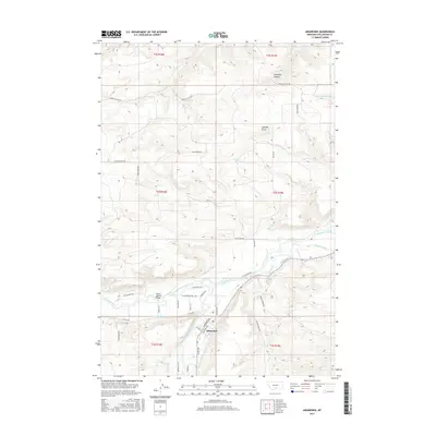
2017 Map of Absarokee
USGS Topo · Published 2017About this map
Absarokee serves as the focal point of this Montana landscape, situated at the confluence where Rosebud Creek meets the Stillwater River. The settlement's development is deeply tied to a complex network of early 20th-century irrigation infrastructure, including the Mendenhall Ditch, Sylvester-Beasley Ditch, and Town Ditch, which redirect water across the valley floor. The Albert Johnson Bridge provides a critical crossing over the Stillwater, connecting the community to the outlying ranch lands.
Find a feature on this map
47 named features on this map. Tap any name to fly to it.
Don’t see what you’re looking for? This feature index may not catch every label — zoom into the map to look around manually.
Map Details
Editions of this 2017 Absarokee Map
This is the sole edition of this map. No revisions or reprints were ever made.
Other maps of this area

1891 · Big Timber
USGS Topo · 1:125,000

1892 · Stillwater
USGS Topo · 1:125,000

1893 · Big Timber
USGS Topo · 1:125,000

1898 · Granite Mountain District
USGS Topo · 1:125,000

1932 · Red Lodge No 2
USGS Topo · 1:48,000

1932 · Nye No 1
USGS Topo · 1:48,000

1954 · Billings
USGS Topo · 1:250,000

1955 · Sandborn Creek
USGS Topo · 1:24,000

1955 · Reed Point
USGS Topo · 1:24,000

1955 · Springtime
USGS Topo · 1:24,000