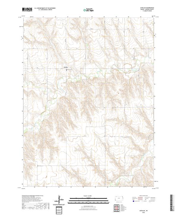
2022 Map of Achilles
USGS Topo · Published 2022About this map
Achilles sits at the heart of this high-plains landscape, where the agricultural grid of Rawlins County is carved by the winding drainage of the Sappa Creek system. The topography is defined by the three distinct branches of the creek—the N Fork Sappa Cr, Middle Fork Sappa Cr, and S Fork Sappa Cr—which slice through the tableland to create a series of draws and ridges. These waterways dictate the local geography, breaking the otherwise rigid township lines of t4s r31w and t4s r32w.
Find a feature on this map
25 named features on this map. Tap any name to fly to it.
Don’t see what you’re looking for? This feature index may not catch every label — zoom into the map to look around manually.
Map Details
Editions of this 2022 Achilles Map
This is the sole edition of this map. No revisions or reprints were ever made.
Other maps of this area

1951 · Selden
USGS Topo · 1:62,500

1951 · Herndon
USGS Topo · 1:62,500

1951 · Achilles
USGS Topo · 1:62,500

1951 · Oberlin
USGS Topo · 1:62,500

1954 · Goodland
USGS Topo · 1:250,000

1956 · Goodland
USGS Topo · 1:250,000

1957 · Goodland
USGS Topo · 1:250,000

1965 · Oberlin SW
USGS Topo · 1:24,000

1965 · Achilles
USGS Topo · 1:24,000

1965 · Selden NW
USGS Topo · 1:24,000