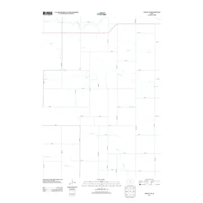
2013 Map of Ackley NE
USGS Topo · Published 2013About this map
Agricultural drainage and the precise geometry of Iowa's township-and-range system define this 2013 survey of Franklin County. The landscape is intricately carved by several watercourses, most notably Hartgrave Cr and Maynes Cr, which meander through a dense network of sectional roads. Smaller tributaries like Fockler Cr, Coon Cr, and Johnson Cr further break up the prairie terrain, illustrating the natural watershed patterns of the North Central Iowa region.
Find a feature on this map
44 named features on this map. Tap any name to fly to it.
Don’t see what you’re looking for? This feature index may not catch every label — zoom into the map to look around manually.
Map Details
Editions of this 2013 Ackley NE Map
This is the sole edition of this map. No revisions or reprints were ever made.
Other maps of this area

1954 · Waterloo
USGS Topo · 1:250,000

1955 · Waterloo
USGS Topo · 1:250,000

1972 · Dumont North
USGS Topo · 1:24,000

1972 · Hansell
USGS Topo · 1:24,000

1972 · Hampton North
USGS Topo · 1:24,000

1979 · Ackley NE
USGS Topo · 1:24,000

1979 · Ackley
USGS Topo · 1:24,000

1979 · Iowa Falls East
USGS Topo · 1:24,000
1979 · Hampton South
USGS Topo · 1:24,000

1979 · Dumont South
USGS Topo · 1:24,000