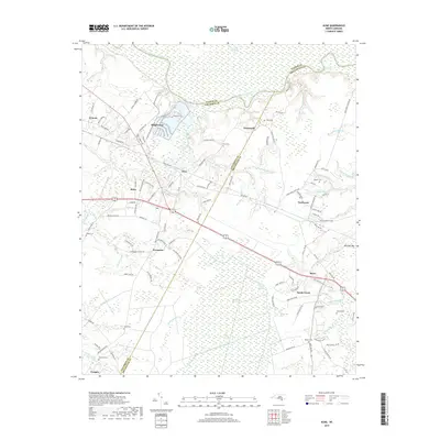
2019 Map of Acme
USGS Topo · Published 2019About this map
The Cape Fear River forms the northern boundary of this coastal plain landscape, where the Pender and Brunswick county lines meet amidst a complex network of wetlands and small tributaries. Industrial and residential clusters like Riegelwood and Acme are defined by their proximity to the river and the corridor of the State Rd 1878. The southern portion of the map is dominated by the sprawling Green Swamp and the Little Green Swamp, characterized by unique features such as Buckhorn Savannah and numerous "bays" including Rattlesnake Bay and Dark Bay. Genealogists will find several family-named burial sites across the territory, including Sykes Cem, Scull Cem, and Rogers Cem, often located near small rural settlements like Delco, Evergreen, and Maco. This survey captures the transition from river-oriented commerce to the inland agriculture and timber lands that define the region.
Find a feature on this map
126 named features on this map. Tap any name to fly to it.
Don’t see what you’re looking for? This feature index may not catch every label — zoom into the map to look around manually.
Map Details
Editions of this 2019 Acme Map
This is the sole edition of this map. No revisions or reprints were ever made.
Other maps of this area

1943 · Honey Island
USGS Topo · 1:24,000

1943 · Winnabow
USGS Topo · 1:24,000

1943 · Lewis Swamp
USGS Topo · 1:24,000

1944 · Winnabow
USGS Topo · 1:31,680

1944 · Lewis Swamp
USGS Topo · 1:31,680

1950 · Winnabow
USGS Topo · 1:25,000

1953 · Florence
USGS Topo · 1:250,000

1954 · Florence
USGS Topo · 1:250,000

1954 · Acme
USGS Topo · 1:62,500

1954 · Bolton
USGS Topo · 1:62,500