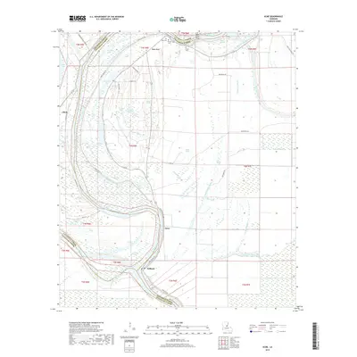
2018 Map of Acme
USGS Topo · Published 2018About this map
Black River and Red River define this wet, low-lying reach where Catahoula Parish, Concordia Parish, and Avoyelles Parish converge. The landscape is dominated by a complex network of bayous, brakes, and oxbow lakes, illustrating the shifting fluvial history of the Mississippi delta region. Small settlements such as New Era, Acme, and Book are linked by the primary road network, including Parish Rd 58-140 and Levee Rd. Genealogists will find several family-named burial sites north of New Era, including Dale Cem, Dewey Cem, and Trisler Cem. The map provides an intricate view of the local drainage patterns, from the Sixmile Bayou to the Pincushion Bayou, alongside numerous stagnant water features like Refuge Brake and Catskin Brake.
Find a feature on this map
59 named features on this map. Tap any name to fly to it.
Don’t see what you’re looking for? This feature index may not catch every label — zoom into the map to look around manually.
Map Details
Editions of this 2018 Acme Map
This is the sole edition of this map. No revisions or reprints were ever made.
Other maps of this area

1935 · Tooleys
USGS Topo · 1:62,500

1939 · Artonish
USGS Topo · 1:62,500

1939 · Deer Park
USGS Topo · 1:62,500

1941 · Voorhies
USGS Topo · 1:62,500

1941 · Tooleys
USGS Topo · 1:62,500

1953 · Natchez
USGS Topo · 1:250,000

1954 · Artonish
USGS Topo · 1:62,500

1955 · Artonish
USGS Topo · 1:62,500

1956 · Natchez
USGS Topo · 1:250,000

1958 · Artonish
USGS Topo · 1:62,500