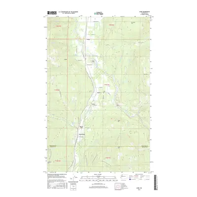
2017 Map of Acme
USGS Topo · Published 2017About this map
The South Fork Nooksack River valley carves through the heart of this landscape, anchoring a string of small settlements including Acme, Saxon, and Wickersham. The terrain is defined by dramatic elevations, from the Van Zandt Dike in the north to the rising slopes of Lyman Hill and Anderson Mtn at the southern boundary. Along the valley floor, the relationship between water and industry is evident at the Marona Mill Pond, while local history is preserved at the Saxon Cem and across the Saxon Bridge. The modern landscape is further marked by the path of the Pacific NW National Scenic Trail, which winds through the southern foothills near Mirror Lake. This survey captures a moment where mountain geography, river drainage systems like Hutchinson Cr and Skookum Cr, and rural road networks converge in the evergreen corridors of Whatcom and Skagit counties.
Find a feature on this map
55 named features on this map. Tap any name to fly to it.
Don’t see what you’re looking for? This feature index may not catch every label — zoom into the map to look around manually.
Map Details
Editions of this 2017 Acme Map
This is the sole edition of this map. No revisions or reprints were ever made.
Other maps of this area

1906 · Sumas
USGS Topo · 1:62,500

1908 · Sumas
USGS Topo · 1:62,500

1918 · Samish Lake
USGS Topo · 1:62,500

1919 · Van Zandt
USGS Topo · 1:62,500

1921 · Wickersham
USGS Topo · 1:62,500

1951 · Wickersham
USGS Topo · 1:62,500

1951 · Van Zandt
USGS Topo · 1:62,500

1952 · Lake Whatcom
USGS Topo · 1:24,000

1952 · Lawrence
USGS Topo · 1:24,000

1952 · Alger
USGS Topo · 1:24,000