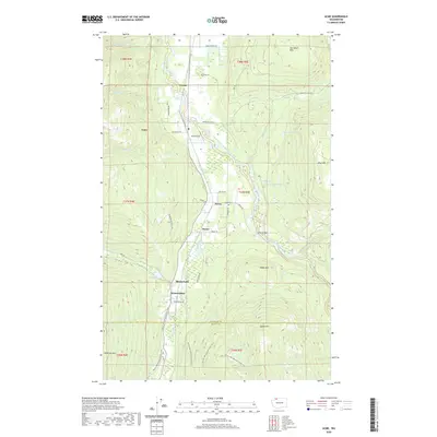
2020 Map of Acme
USGS Topo · Published 2020About this map
The South Fork Nooksack River valley carves through the heart of this landscape, anchoring small settlements like Acme and Saxon. This corridor is defined by the steep rise of Van Zandt Dike to the east and the sprawling elevations of Lyman Hill and Anderson Mtn to the south. Historically significant features are scattered throughout the lowlands, including the Saxon Cem and the small airfield at Acme Field.
Find a feature on this map
54 named features on this map. Tap any name to fly to it.
Don’t see what you’re looking for? This feature index may not catch every label — zoom into the map to look around manually.
Map Details
Editions of this 2020 Acme Map
This is the sole edition of this map. No revisions or reprints were ever made.
Other maps of this area

1906 · Sumas
USGS Topo · 1:62,500

1908 · Sumas
USGS Topo · 1:62,500

1918 · Samish Lake
USGS Topo · 1:62,500

1919 · Van Zandt
USGS Topo · 1:62,500

1921 · Wickersham
USGS Topo · 1:62,500

1951 · Wickersham
USGS Topo · 1:62,500

1951 · Van Zandt
USGS Topo · 1:62,500

1952 · Lake Whatcom
USGS Topo · 1:24,000

1952 · Lawrence
USGS Topo · 1:24,000

1952 · Alger
USGS Topo · 1:24,000