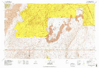
1978 Map of Acoma Pueblo
USGS Topo · Published 1979About this map
Acoma Pueblo serves as a historic focal point within the high desert landscape of New Mexico, situated between the basalt flows of The Malpais and the massive elevations of Cebollita Mesa. In the late 1970s, the region was defined by its vast land grants and reservations, including the Acoma Indian Reservation, Laguna Indian Reservation, and a portion of the Isleta Indian Reservation. The mapping records a transition in transportation technology, where the route of U.S. 66 and the Atchison Topeka and Santa Fe RR parallel the newer corridor of Interstate 40 near Correo.
Find a feature on this map
77 named features on this map. Tap any name to fly to it.
Don’t see what you’re looking for? This feature index may not catch every label — zoom into the map to look around manually.
Map Details
Editions of this 1978 Acoma Pueblo Map
This is the sole edition of this map. No revisions or reprints were ever made.
Other maps of this area

1883 · Mt. Taylor
USGS Topo · 1:250,000

1886 · Wingate
USGS Topo · 1:250,000

1886 · Mt. Taylor
USGS Topo · 1:250,000

1888 · Bernalillo
USGS Topo · 1:125,000

1889 · Albuquerque
USGS Topo · 1:125,000

1892 · Wingate
USGS Topo · 1:250,000

1892 · Mt. Taylor
USGS Topo · 1:250,000

1893 · Albuquerque
USGS Topo · 1:125,000

1899 · Mt. Taylor
USGS Topo · 1:250,000

1916 · La Joya
USGS Topo · 1:125,000