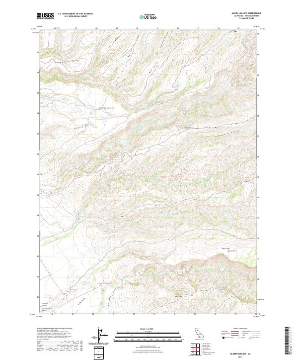
2021 Map of Acorn Hollow
USGS Topo · Published 2021About this map
Acorn Hollow and the surrounding drainage basins of the eastern Sacramento Valley reveal a landscape defined by seasonal watercourses and prominent ridgelines. The transition from the flatlands into the foothills is marked by a series of north-south running heights, including Campo Seco Ridge, Red Ridge, and Allen Ridge. These formations guide the flow of numerous streams such as Mill Cr, Wildcat Cr, and Deer Creek, which carve deep incisions into the terrain like Wildcat Canyon and Hubbard Gulch.
Find a feature on this map
36 named features on this map. Tap any name to fly to it.
Don’t see what you’re looking for? This feature index may not catch every label — zoom into the map to look around manually.
Map Details
Editions of this 2021 Acorn Hollow Map
This is the sole edition of this map. No revisions or reprints were ever made.
Other maps of this area

1886 · Lassen Peak
USGS Topo · 1:250,000

1890 · Red Bluff
USGS Topo · 1:250,000

1891 · Chico
USGS Topo · 1:125,000

1892 · Lassen Peak
USGS Topo · 1:250,000

1893 · Chico
USGS Topo · 1:125,000

1894 · Lassen Peak
USGS Topo · 1:250,000

1894 · Red Bluff
USGS Topo · 1:250,000

1895 · Chico
USGS Topo · 1:125,000

1904 · Vina
USGS Topo · 1:62,500

1905 · Tehama
USGS Topo · 1:62,500