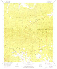
1958 Map of Acorn
USGS Topo · Published 1976About this map
Ouachita National Forest dominates this landscape, where the rugged terrain of Fourche Mountain and Blansett Ridge dictates the path of early infrastructure. The settlement of Acorn sits at a vital junction where the Kansas City Southern railroad meets the winding course of the Ouachita River. This 1958 field check documents a community anchored by local landmarks like Acorn Ch, Union Grove Ch, and the Foran Cem located near the base of Foran Gap. The topographical detail reveals the complex drainage systems of Heath Creek and Pitman Creek flowing through the ridges, while the inclusion of Skyline Drive along the mountain crests indicates the early development of recreational corridors through these forest lands. Purple photorevisions from 1975 show minor updates to the transportation network and local structures, providing a layered view of mid-century growth in this part of Polk and Scott counties.
Find a feature on this map
25 named features on this map. Tap any name to fly to it.
Don’t see what you’re looking for? This feature index may not catch every label — zoom into the map to look around manually.
Map Details
Editions of this 1958 Acorn Map
2 editions found
Other maps of this area

1879 · Poteau Mountain
USGS Topo · 1:62,500

1887 · Poteau Mountain #1
USGS Topo · 1:62,500

1887 · Poteau Mountain #2
USGS Topo · 1:62,500

1890 · Poteau Mountain
USGS Topo · 1:125,000

1899 · Poteau Mountain
USGS Topo · 1:125,000

1939 · Waldron
USGS Topo · 1:62,500

1940 · Waldron
USGS Topo · 1:62,500

1941 · Waldron
USGS Topo · 1:62,500

1949 · Waldron
USGS Topo · 1:62,500

1950 · Mcalester
USGS Topo · 1:250,000