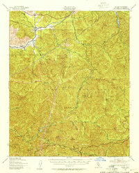
1940 Map of Acton
USGS Topo · Published 1955About this map
Acton and Ravenna serve as the primary northern outposts in this landscape, situated along the Southern Pacific railroad corridor through Soledad Canyon. The terrain is dominated by the high ridges of the San Gabriel Mountains and the protected lands of the Angeles National Forest. For researchers of the region's industrial past, the presence of the Monte Cristo Mine tucked into the upper reaches of Mill Creek provides a clear marker of the area's mining history.
Find a feature on this map
52 named features on this map. Tap any name to fly to it.
Don’t see what you’re looking for? This feature index may not catch every label — zoom into the map to look around manually.
Map Details
Editions of this 1940 Acton Map
This is the sole edition of this map. No revisions or reprints were ever made.
Other maps of this area

1894 · Los Angeles
USGS Topo · 1:62,500

1894 · Pomona
USGS Topo · 1:62,500

1896 · Pasadena
USGS Topo · 1:62,500

1896 · Santa Monica
USGS Topo · 1:62,500

1897 · Pomona
USGS Topo · 1:62,500

1898 · Pomona
USGS Topo · 1:62,500

1898 · Santa Monica
USGS Topo · 1:62,500

1900 · Pasadena
USGS Topo · 1:62,500

1900 · Tujunga
USGS Topo · 1:62,500

1900 · Los Angeles
USGS Topo · 1:62,500