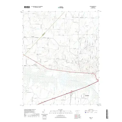
2019 Map of Adair
USGS Topo · Published 2019About this map
The South Fork Forked Deer River dominates the southern landscape of this West Tennessee quadrangle, where the Crockett County and Madison County border cuts across rural agricultural lands. Small settlements and crossroads like Adair, Windy City, and Gum Flat dot the terrain north of the river, connected by an intricate network of local roads including Old Humboldt Rd and Old Jackson Rd. The area is notably dense with family burial grounds and small community graveyards, such as the Randolph Family Cem, McLemore Cem, and De Loach Cem. These sites, along with the proximity to the northern outskirts of Jackson, reveal a pattern of longstanding land ownership and family-centered rural communities. Numerous creeks, including Cypress Cr and Pearsons Cr, feed into the river valley, creating a well-watered topography that has historically defined the region's development.
Find a feature on this map
115 named features on this map. Tap any name to fly to it.
Don’t see what you’re looking for? This feature index may not catch every label — zoom into the map to look around manually.
Map Details
Editions of this 2019 Adair Map
This is the sole edition of this map. No revisions or reprints were ever made.
Other maps of this area

1950 · Jackson South
USGS Topo · 1:24,000

1950 · Jackson North
USGS Topo · 1:24,000

1951 · Jackson North
USGS Topo · 1:24,000

1956 · Blytheville
USGS Topo · 1:250,000

1959 · Medina
USGS Topo · 1:24,000

1959 · Blytheville
USGS Topo · 1:250,000

1959 · Bells
USGS Topo · 1:24,000

1959 · Westover
USGS Topo · 1:24,000

1959 · Denmark
USGS Topo · 1:24,000

1959 · Adair
USGS Topo · 1:24,000