
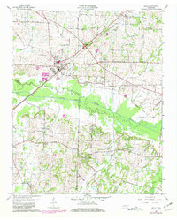
1959 Map of Bells
USGS Topo · Published 1960About this map
The town of Bells serves as a central hub in this West Tennessee landscape, situated at the junction of the Gulf Mobile and Ohio and the Louisville and Nashville railroads. This intersection established the area as a significant transport point for agricultural goods during the mid-20th century. The terrain is defined by the winding course of the South Fork Forked Deer River, which forms the boundary between Crockett, Haywood, and Madison counties.
Find a feature on this map
43 named features on this map. Tap any name to fly to it.
Don’t see what you’re looking for? This feature index may not catch every label — zoom into the map to look around manually.
Map Details
Editions of this 1959 Bells Map
2 editions found
Other maps of this area

1950 · Sunnyhill
USGS Topo · 1:24,000

1951 · Sunnyhill
USGS Topo · 1:24,000

1956 · Blytheville
USGS Topo · 1:250,000

1959 · Blytheville
USGS Topo · 1:250,000

1959 · Westover
USGS Topo · 1:24,000

1959 · Denmark
USGS Topo · 1:24,000

1959 · Adair
USGS Topo · 1:24,000

1959 · Humboldt
USGS Topo · 1:24,000

1961 · Jones
USGS Topo · 1:24,000
1964 · Maury City
USGS Topo · 1:24,000