
1959 Map of Adair
USGS Topo · Published 1960About this map
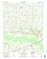
South Fork Forked Deer River meanders through the heart of the Madison County landscape, defining the topography of this rural Tennessee region in the late 1950s. The settlement at Adair serves as a central point along the Jackson-Bells Highway, while smaller communities like Windy City and Gum Flat dot the surrounding farmland. The Gulf Mobile and Ohio railroad corridor cuts across the terrain, paralleling the river and providing a vital transit link between local agricultural hubs.
Find a feature on this map
46 named features on this map. Tap any name to fly to it.
Don’t see what you’re looking for? This feature index may not catch every label — zoom into the map to look around manually.
Map Details
Editions of this 1959 Adair Map
4 editions found
Other maps of this area

1950 · Jackson South
USGS Topo · 1:24,000

1950 · Jackson North
USGS Topo · 1:24,000

1951 · Jackson North
USGS Topo · 1:24,000

1956 · Blytheville
USGS Topo · 1:250,000

1959 · Medina
USGS Topo · 1:24,000

1959 · Blytheville
USGS Topo · 1:250,000

1959 · Bells
USGS Topo · 1:24,000

1959 · Westover
USGS Topo · 1:24,000

1959 · Denmark
USGS Topo · 1:24,000

1959 · Humboldt
USGS Topo · 1:24,000