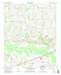
1959 Map of Adair
USGS Topo · Published 1979About this map
The South Fork Forked Deer River meanders across the southern landscape of this West Tennessee quadrangle, defining the terrain between the growing Jackson corporate boundary and rural communities to the north. In the mid-20th century, the Illinois Central Gulf railroad provided a vital corridor through the countryside, passing just north of the river near Roberts. The area is characterized by numerous family-named landmarks and small-scale social centers like Poplar Corner Ch and Mason Grove Sch, reflecting a deeply rooted agricultural society.
Find a feature on this map
44 named features on this map. Tap any name to fly to it.
Don’t see what you’re looking for? This feature index may not catch every label — zoom into the map to look around manually.
Map Details
Editions of this 1959 Adair Map
4 editions found
Other maps of this area

1950 · Jackson South
USGS Topo · 1:24,000

1950 · Jackson North
USGS Topo · 1:24,000

1951 · Jackson North
USGS Topo · 1:24,000

1956 · Blytheville
USGS Topo · 1:250,000

1959 · Medina
USGS Topo · 1:24,000

1959 · Blytheville
USGS Topo · 1:250,000

1959 · Bells
USGS Topo · 1:24,000

1959 · Westover
USGS Topo · 1:24,000

1959 · Denmark
USGS Topo · 1:24,000

1959 · Adair
USGS Topo · 1:24,000