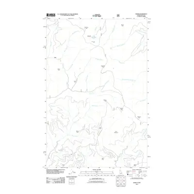
2011 Map of Adair
USGS Topo · Published 2011About this map
Hansey Mines and the Silver Lake Mine operations mark this mountainous section of Shoshone County, indicating a landscape defined by mineral extraction and high-elevation terrain. Located near the Adair settlement, the area is characterized by a series of prominent summits including Dominion Peak, Storm Peak, and Grays Peak. The hydrological network is dominated by the upper reaches of Loop Creek, Kelly Creek, and the West Fork Big Creek, which carve through the steep topography. Infrastructure is limited to forest developments like Nat For Dev RD 391 and Bird Creek Rd, which provide access to remote landmarks such as Silver Lake and the Silver Lake West Mine. The concentration of named points like Point Henry and Point Eightyone suggests a region heavily utilized for geographic observation and natural resource management within the national forest system.
Find a feature on this map
44 named features on this map. Tap any name to fly to it.
Don’t see what you’re looking for? This feature index may not catch every label — zoom into the map to look around manually.
Map Details
Editions of this 2011 Adair Map
This is the sole edition of this map. No revisions or reprints were ever made.
Other maps of this area

1914 · Avery
USGS Topo · 1:125,000

1917 · Avery
USGS Topo · 1:125,000

1918 · St Regis
USGS Topo · 1:125,000

1919 · St. Regis
USGS Topo · 1:125,000

1956 · Saltese
USGS Topo · 1:62,500

1956 · Wallace
USGS Topo · 1:250,000

1957 · Haugan
USGS Topo · 1:62,500

1957 · Simmons Peak
USGS Topo · 1:62,500

1960 · Wallace
USGS Topo · 1:250,000
1969 · Thor Mountain
USGS Topo · 1:24,000