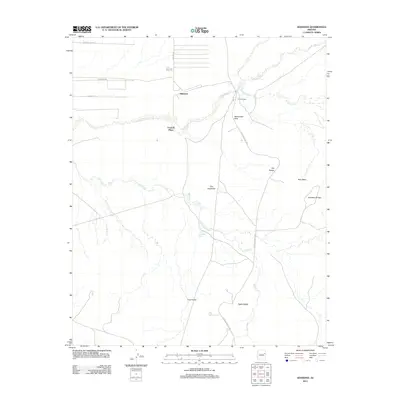
2011 Map of Adamana
USGS Topo · Published 2011About this map
Adamana serves as a focal point in this landscape where the Puerco River meets a network of arroyos and washes. The geography is defined by geological formations and archaeological sites, including the ancient stone structures of Puerco Pueblo and the petroglyphs at Newspaper Rock. To the south, the Petrified Forest HWY provides access to distinct erosion features like The Tepees, The Haystacks, and Blue Mesa. This area is shaped by a high-desert drainage system, where Ninemile Wash and Dry Creek cross the terrain. Human presence is sparse, marked by the small settlement of Paulcell Place and a few ranch roads such as Cattleman RD. Notable natural crossings and formations like Agate Bridge and the First Forest demonstrate the unique concentration of fossilized wood and ancient history preserved in this corner of Apache County.
Find a feature on this map
19 named features on this map. Tap any name to fly to it.
Don’t see what you’re looking for? This feature index may not catch every label — zoom into the map to look around manually.
Map Details
Editions of this 2011 Adamana Map
This is the sole edition of this map. No revisions or reprints were ever made.
Other maps of this area

1886 · St Johns
USGS Topo · 1:250,000

1886 · Fort Defiance
USGS Topo · 1:250,000

1892 · Fort Defiance
USGS Topo · 1:250,000

1892 · St Johns
USGS Topo · 1:250,000

1912 · Petrified Forest
USGS Topo · 1:62,500

1954 · Saint Johns
USGS Topo · 1:250,000

1954 · Gallup
USGS Topo · 1:250,000

1955 · Petrified Forest
USGS Topo · 1:62,500

1955 · Adamana 1 SW
USGS Topo · 1:24,000

1956 · Adamana 1 NW
USGS Topo · 1:24,000