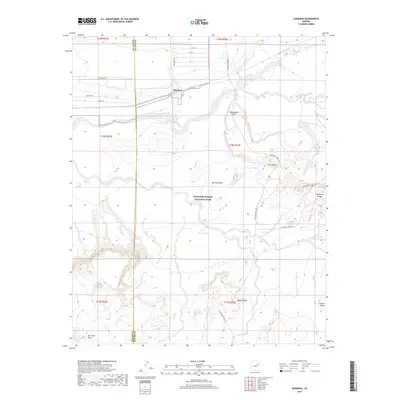
2018 Map of Adamana
USGS Topo · Published 2018About this map
Petrified Forest National Park dominates the center of this landscape, where the high desert terrain of Eastern Arizona is deeply etched by the Puerco River and Ninemile Wash. The settlement of Adamana sits along the northern edge, serving as a gateway to this geologically significant region. The map reveals the intricate drainage patterns of Dry Cr and its tributaries, including the E Fork Dry Cr, which have carved out the unique formations that give the park its character. Notable landmarks such as Newspaper Rock, The Teepees, and The Haystacks are clearly identified, alongside significant erosion-carved spans like Agate Bridge and Keystone Bridge. The presence of the Navajo Co and Apache Co boundary line highlights the administrative division of this protected wilderness.
Find a feature on this map
31 named features on this map. Tap any name to fly to it.
Don’t see what you’re looking for? This feature index may not catch every label — zoom into the map to look around manually.
Map Details
Editions of this 2018 Adamana Map
This is the sole edition of this map. No revisions or reprints were ever made.
Other maps of this area

1886 · St Johns
USGS Topo · 1:250,000

1886 · Fort Defiance
USGS Topo · 1:250,000

1892 · Fort Defiance
USGS Topo · 1:250,000

1892 · St Johns
USGS Topo · 1:250,000

1912 · Petrified Forest
USGS Topo · 1:62,500

1954 · Saint Johns
USGS Topo · 1:250,000

1954 · Gallup
USGS Topo · 1:250,000

1955 · Petrified Forest
USGS Topo · 1:62,500

1955 · Adamana 1 SW
USGS Topo · 1:24,000

1956 · Adamana 1 NW
USGS Topo · 1:24,000