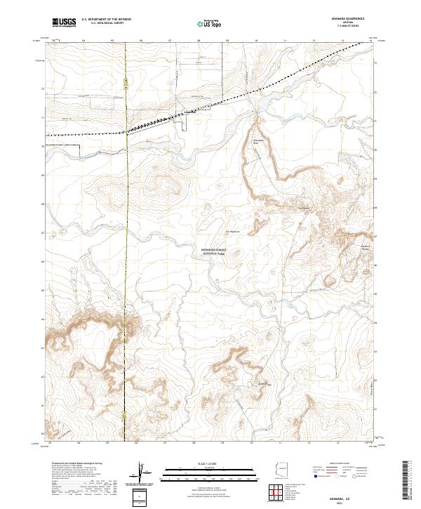
2021 Map of Adamana
USGS Topo · Published 2021About this map
The settlement of Adamana sits along a northern corridor of local roads and rail access, serving as a gateway to the surrounding high desert. This region is defined by the extensive boundaries of Petrified Forest National Park, where the landscape is marked by unique geologic formations and prehistoric sites. The Puerco River and its seasonal tributaries, such as Ninemile Wash and Dry Cr, cut through the terrain, influencing the placement of early crossings and travel routes. Notable landmarks like Newspaper Rock and The Tepees indicate the area's significance for both natural history and archeology. Cultural features such as Agate Bridge and Keystone Bridge demonstrate how the park's infrastructure was designed to highlight these natural wonders, while the Blue Mesa Scenic Rd provides a dedicated path for exploring the layered clay and siltstone formations of the The Haystacks.
Find a feature on this map
31 named features on this map. Tap any name to fly to it.
Don’t see what you’re looking for? This feature index may not catch every label — zoom into the map to look around manually.
Map Details
Editions of this 2021 Adamana Map
This is the sole edition of this map. No revisions or reprints were ever made.
Other maps of this area

1886 · St Johns
USGS Topo · 1:250,000

1886 · Fort Defiance
USGS Topo · 1:250,000

1892 · Fort Defiance
USGS Topo · 1:250,000

1892 · St Johns
USGS Topo · 1:250,000

1912 · Petrified Forest
USGS Topo · 1:62,500

1954 · Saint Johns
USGS Topo · 1:250,000

1954 · Gallup
USGS Topo · 1:250,000

1955 · Petrified Forest
USGS Topo · 1:62,500

1955 · Adamana 1 SW
USGS Topo · 1:24,000

1956 · Adamana 1 NW
USGS Topo · 1:24,000