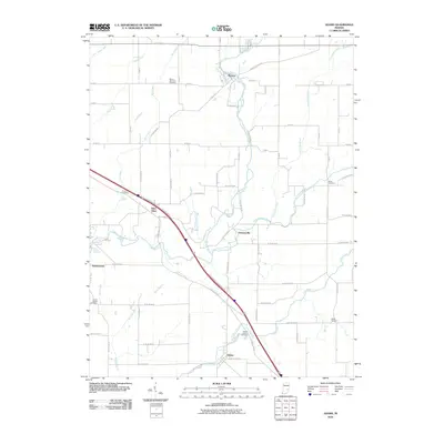
2010 Map of Adams
USGS Topo · Published 2010About this map
Flatrock River and its tributary, the Little Flatrock River, dominate the drainage of this rural landscape, where grid-patterned county roads connect small, scattered settlements. The historic community of Saint Omer sits along the diagonal corridor of N Michigan Ave and the interstate frontage, while the hamlet of Moscow is situated at a bridge crossing of the main river. For genealogists, the map is particularly valuable for its documentation of numerous burial grounds that serve these small agrarian communities, including the Mount Morrison Cemetery near the northern boundary and Shiloh Cemetery to the southeast. The land is intricately partitioned by drainage ditches and creeks, such as Apple Ditch and Mill Creek, which define the agricultural productivity of the region. Local transit is anchored by named routes like W Skating Rink Rd and S Prill Rd, which provide access to smaller pockets like Downeyville and Adams.
Find a feature on this map
42 named features on this map. Tap any name to fly to it.
Don’t see what you’re looking for? This feature index may not catch every label — zoom into the map to look around manually.
Map Details
Editions of this 2010 Adams Map
This is the sole edition of this map. No revisions or reprints were ever made.
Other maps of this area

1942 · Columbus
USGS Topo · 1:125,000

1953 · Cincinnati
USGS Topo · 1:250,000

1956 · Waldron
USGS Topo · 1:24,000

1956 · Rays Crossing
USGS Topo · 1:24,000

1957 · Cincinnati
USGS Topo · 1:250,000

1958 · Greensburg
USGS Topo · 1:24,000

1958 · Forest Hill
USGS Topo · 1:24,000

1958 · Hartsville
USGS Topo · 1:24,000

1959 · Milroy
USGS Topo · 1:24,000

1959 · Rushville
USGS Topo · 1:24,000