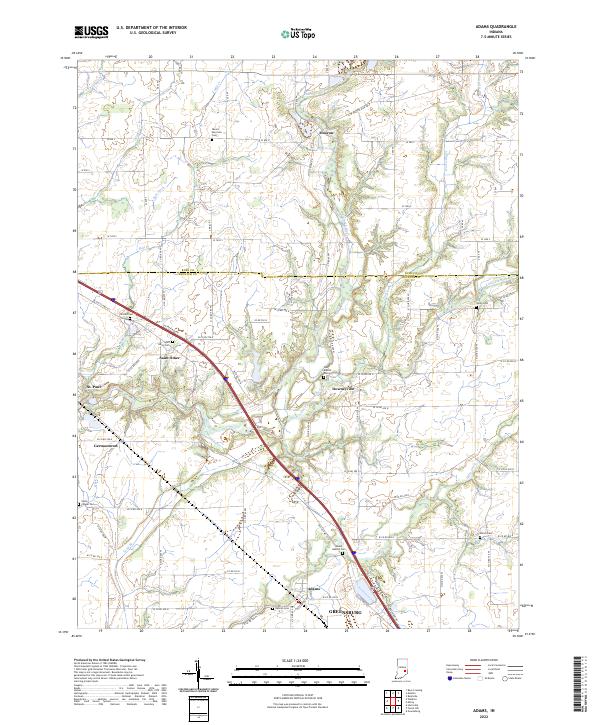
2022 Map of Adams
USGS Topo · Published 2022About this map
Moscow and Saint Omer anchor a landscape defined by the branching tributaries of the Flatrock River along the border of Rush and Decatur counties. This modern topographic study reveals a rural network of county roads and historic cemeteries that speak to generations of family settlement. Significant burial grounds like Mount Morrison Cem and Saint Omer Cem are preserved among the agricultural tracts, while Star Baptist Ch serves as a local landmark in Downeyville. The area's hydrology is complex, with Little Flatrock River, Hurricane Cr, and Clifty Creek carving through the terrain towards the northern outskirts of Greensburg. The path of Old US Hwy 421 cuts diagonally across the township, tracing a traditional transit corridor through Adams and Germantown.
Find a feature on this map
52 named features on this map. Tap any name to fly to it.
Don’t see what you’re looking for? This feature index may not catch every label — zoom into the map to look around manually.
Map Details
Editions of this 2022 Adams Map
This is the sole edition of this map. No revisions or reprints were ever made.
Other maps of this area

1942 · Columbus
USGS Topo · 1:125,000

1953 · Cincinnati
USGS Topo · 1:250,000

1956 · Waldron
USGS Topo · 1:24,000

1956 · Rays Crossing
USGS Topo · 1:24,000

1957 · Cincinnati
USGS Topo · 1:250,000

1958 · Greensburg
USGS Topo · 1:24,000

1958 · Forest Hill
USGS Topo · 1:24,000

1958 · Hartsville
USGS Topo · 1:24,000

1959 · Milroy
USGS Topo · 1:24,000

1959 · Rushville
USGS Topo · 1:24,000