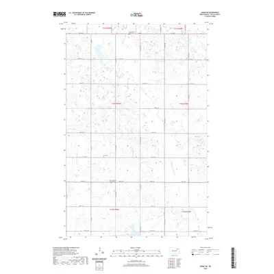
2020 Map of Adams SW
USGS Topo · Published 2020About this map
Saint Catherine's of Lomice Cem and Pecka Cem sit within the rural grid of western Walsh County, marking the cultural footprint of early settlement in this agricultural landscape. The terrain is defined by the wandering course of the Middle Br Forest River, which cuts through the southeastern portion of the quadrangle. A network of section-line roads, including Co Rd 22 and Co Rd 22A, connects isolated farmsteads and points of local heritage like the Vang Lutheran Church Cem in the north. This survey illustrates the persistent township and range structure of North Dakota's prairie, where small cemeteries often remain the most prominent landmarks of the original pioneer communities.
Find a feature on this map
29 named features on this map. Tap any name to fly to it.
Don’t see what you’re looking for? This feature index may not catch every label — zoom into the map to look around manually.
Map Details
Editions of this 2020 Adams SW Map
This is the sole edition of this map. No revisions or reprints were ever made.
Other maps of this area

1953 · Devils Lake
USGS Topo · 1:250,000

1956 · Devils Lake
USGS Topo · 1:250,000

1971 · Whitman
USGS Topo · 1:24,000

1971 · Brocket
USGS Topo · 1:24,000

1971 · Pelto
USGS Topo · 1:24,000

1972 · Adams
USGS Topo · 1:24,000

1972 · Adams SW
USGS Topo · 1:24,000

1972 · Fairdale
USGS Topo · 1:24,000

1972 · Edmore NE
USGS Topo · 1:24,000

1972 · Lawton
USGS Topo · 1:24,000