
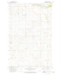
1972 Map of Fairdale
USGS Topo · Published 1975About this map
Fairdale anchors the northern portion of this Walsh County landscape, shown here in the early 1970s as a structured prairie community defined by its connection to the Soo Line railroad. The surrounding townships of Kinloss, Silvesta, Dewey, and Adams reveal a high density of rural religious and burial sites, which suggest the deep heritage of the region's early settlers. Researchers can identify numerous family or community landmarks, including the Ohnstad Cem and the distinct locations of Old Aadalen Cem and the newer Aadalen Cem. The map's fine red dashed lines capture the precise layout of field and fence boundaries across the pothole-scattered terrain, while local gathering points like the Townhall and Adolphus Ch indicate the social hubs that supported this agricultural district during the latter half of the twentieth century.
Find a feature on this map
16 named features on this map. Tap any name to fly to it.
Don’t see what you’re looking for? This feature index may not catch every label — zoom into the map to look around manually.
Map Details
Editions of this 1972 Fairdale Map
This is the sole edition of this map. No revisions or reprints were ever made.
Other maps of this area

1953 · Devils Lake
USGS Topo · 1:250,000

1956 · Devils Lake
USGS Topo · 1:250,000

1972 · Nekoma
USGS Topo · 1:24,000

1972 · Osnabrock SW
USGS Topo · 1:24,000

1972 · Adams
USGS Topo · 1:24,000

1972 · Adams SW
USGS Topo · 1:24,000

1972 · Edmore NE
USGS Topo · 1:24,000

1972 · Lawton
USGS Topo · 1:24,000
1972 · Adams SE
USGS Topo · 1:24,000
1972 · Waterloo Lake
USGS Topo · 1:24,000