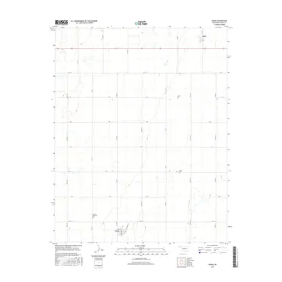
2016 Map of Adams
USGS Topo · Published 2016About this map
Adams serves as a focal point for this section of the High Plains, where a strict section-line road grid organizes the agricultural landscape. The settlement's layout is centered on Broadway and Railroad St, with the nearby Klassen label indicating local family or property associations. To the north, the small community of Baker sits along U.S. Route 64, a primary east-west artery through Texas County. The map is particularly notable for its preservation of several remote burial grounds, including the Krimmer Mennonite Cem, Happy Cem, and Denman Cem, which stand as significant markers for genealogists and local historians tracing early 20th-century settlement patterns in this part of Oklahoma.
Find a feature on this map
26 named features on this map. Tap any name to fly to it.
Don’t see what you’re looking for? This feature index may not catch every label — zoom into the map to look around manually.
Map Details
Editions of this 2016 Adams Map
This is the sole edition of this map. No revisions or reprints were ever made.
Other maps of this area

1954 · Perryton
USGS Topo · 1:250,000

1958 · Perryton
USGS Topo · 1:250,000

1967 · Hooker
USGS Topo · 1:24,000

1967 · Adams
USGS Topo · 1:24,000

1967 · Hooker NW
USGS Topo · 1:24,000

1967 · Tyrone
USGS Topo · 1:24,000

1968 · Optima Dam
USGS Topo · 1:24,000

1968 · Hardesty NE
USGS Topo · 1:24,000

1973 · Little Ponderosa
USGS Topo · 1:24,000

1973 · Red Horse Creek
USGS Topo · 1:24,000