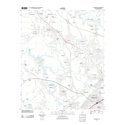
2011 Map of Adamsville
USGS Topo · Published 2011About this map
Adamsville and its surrounding coal-country settlements define this landscape in the hills west of Birmingham. The presence of the Mulga Mine near the center of the sheet speaks to the industrial heritage of the area, where rail lines once served active pits. Several historical residential clusters, such as Docena, Mulga, and Republic, are mapped alongside a high density of local burial grounds. Genealogists will find numerous small cemeteries including Village Falls Cemetery, Glasgow Hill Cemetery, and the George Washington Memorial Gardens Cemetery. The map also illustrates the path of the proposed Future I-22, showing the transition of the region's transport network from the old industrial ways to modern interstate corridors. Significant water features like Bayview Lake and Village Creek carve through the terrain, flanked by ridges such as Glasgow Ridge.
Find a feature on this map
188 named features on this map. Tap any name to fly to it.
Don’t see what you’re looking for? This feature index may not catch every label — zoom into the map to look around manually.
Map Details
Editions of this 2011 Adamsville Map
This is the sole edition of this map. No revisions or reprints were ever made.
Other maps of this area

1889 · Birmingham
USGS Topo · 1:125,000

1890 · Bessemer
USGS Topo · 1:125,000

1892 · Birmingham
USGS Topo · 1:125,000

1892 · Bessemer
USGS Topo · 1:125,000

1893 · Jasper
USGS Topo · 1:125,000

1895 · Birmingham
USGS Topo · 1:125,000

1899 · Brookwood
USGS Topo · 1:125,000

1904 · Birmingham Coal District
USGS Topo · 1:62,500

1905 · Bessemer Iron District
USGS Topo · 1:62,500

1906 · Birmingham Special
USGS Topo · 1:62,500