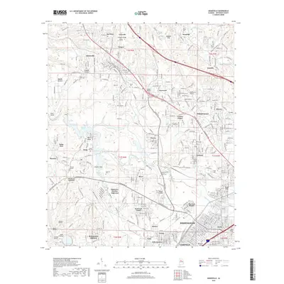
2018 Map of Adamsville
USGS Topo · Published 2018About this map
Mulga Mine and the industrial corridors of the BNSF Railway anchor this landscape on the northwestern edge of the Birmingham metropolitan area. The terrain is marked by numerous family and community landmarks, including Bivens Chapel Cem near Brookside and Glasgow Hill Cem on the ridge overlooking Graysville. The presence of Bonham Airport near Maytown and the water-filled expanse of Bayview Lake reflect the diverse land use in this part of Jefferson County. Transport networks define the geography, from the Birmingport Rd corridor to the rail intersections at Crockard Junction and Edgewater Junction. This survey reveals the dense settlement patterns of communities like Forestdale, Adamsville, and Pratt City, while identifying smaller locales such as MacDonald Hollow and Shady Grove. Genealogical value is found in the many church sites, such as Crumley Chapel and McDonald Chapel.
Find a feature on this map
116 named features on this map. Tap any name to fly to it.
Don’t see what you’re looking for? This feature index may not catch every label — zoom into the map to look around manually.
Map Details
Editions of this 2018 Adamsville Map
This is the sole edition of this map. No revisions or reprints were ever made.
Other maps of this area

1889 · Birmingham
USGS Topo · 1:125,000

1890 · Bessemer
USGS Topo · 1:125,000

1892 · Birmingham
USGS Topo · 1:125,000

1892 · Bessemer
USGS Topo · 1:125,000

1893 · Jasper
USGS Topo · 1:125,000

1895 · Birmingham
USGS Topo · 1:125,000

1899 · Brookwood
USGS Topo · 1:125,000

1904 · Birmingham Coal District
USGS Topo · 1:62,500

1905 · Bessemer Iron District
USGS Topo · 1:62,500

1906 · Birmingham Special
USGS Topo · 1:62,500