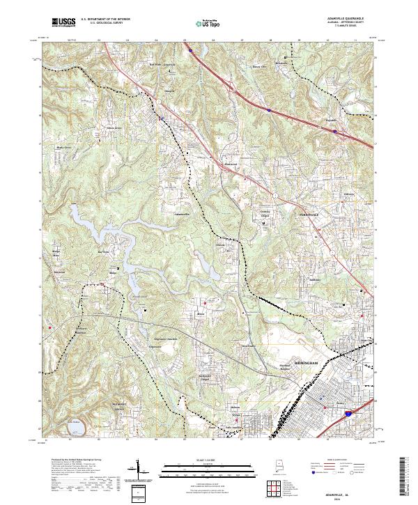
2024 Map of Adamsville
USGS Topo · Published 2024About this map
Birmingham's industrial and residential fringes are captured here, revealing a landscape deeply influenced by its mining and rail history. The presence of Mulga Mine near the settlements of Mulga and Maytown reflects the region's enduring connection to the coal industry. The map illustrates a dense network of suburban and industrial communities, from the established neighborhoods of Forestdale and Ensley to smaller locales like Daisey City and Glasgow.
Find a feature on this map
85 named features on this map. Tap any name to fly to it.
Don’t see what you’re looking for? This feature index may not catch every label — zoom into the map to look around manually.
Map Details
Editions of this 2024 Adamsville Map
This is the sole edition of this map. No revisions or reprints were ever made.
Other maps of this area

1889 · Birmingham
USGS Topo · 1:125,000

1890 · Bessemer
USGS Topo · 1:125,000

1892 · Birmingham
USGS Topo · 1:125,000

1892 · Bessemer
USGS Topo · 1:125,000

1893 · Jasper
USGS Topo · 1:125,000

1895 · Birmingham
USGS Topo · 1:125,000

1899 · Brookwood
USGS Topo · 1:125,000

1904 · Birmingham Coal District
USGS Topo · 1:62,500

1905 · Bessemer Iron District
USGS Topo · 1:62,500

1906 · Birmingham Special
USGS Topo · 1:62,500