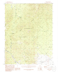
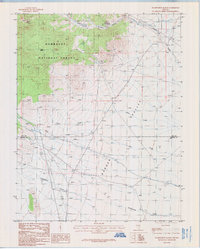
1985 Map of Adaven
USGS Topo · Published 1986About this map
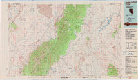
Adaven sits at the southern edge of the Grant Range, a remote high-elevation landscape within the Humboldt National Forest at the mid-1980s. This survey records a complex terrain of deep drainages including Cherry Creek Canyon and Little Sawmill Canyon, where seasonal water sources like Burnt Canyon Spring and Ox Spring provided essential relief in the arid environment. Evidence of local mining interests is visible through various Prospects scattered across the slopes above Garden Valley. Notable for travelers of the era, the map identifies the Cherry Creek Summit and a nearby Picnic Area, marking the transition points between the high mountain passes and the broad desert washes of Quinn Canyon Wash. The inclusion of an Indefinite Bdy suggests the сложности of surveying this high-relief Nevada interior.
Find a feature on this map
17 named features on this map. Tap any name to fly to it.
Don’t see what you’re looking for? This feature index may not catch every label — zoom into the map to look around manually.
Map Details
Editions of this 1985 Adaven Map
This is the sole edition of this map. No revisions or reprints were ever made.
Other maps of this area

1956 · Lund
USGS Topo · 1:250,000

1960 · Lund
USGS Topo · 1:250,000
1964 · Troy Canyon
USGS Topo · 1:62,500
1964 · Forest Home
USGS Topo · 1:62,500
1985 · Badger Gulch
USGS Topo · 1:24,000
1985 · Wadsworth Ranch
USGS Topo · 1:24,000
1985 · Water Gap NW
USGS Topo · 1:24,000
1985 · Nyala
USGS Topo · 1:24,000
1985 · Water Gap West
USGS Topo · 1:24,000
1988 · Quinn Canyon Range
USGS Topo · 1:100,000