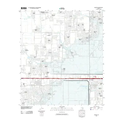
2010 Map of Addicks
USGS Topo · Published 2010About this map
Barker Reservoir dominates the southern landscape of this West Houston periphery, a massive flood-control feature defined by the Barker Dam and the winding course of Buffalo Bayou. This 2010 survey illustrates a period of intense residential expansion, where former agricultural tracts have been replaced by a dense network of suburban subdivisions like Westlake Village, Settlers Village, and Bear Creek Plantation. Despite this modernization, local history remains anchored at sites like Baker Cemetery near the reservoir's edge.
Find a feature on this map
82 named features on this map. Tap any name to fly to it.
Don’t see what you’re looking for? This feature index may not catch every label — zoom into the map to look around manually.
Map Details
Editions of this 2010 Addicks Map
This is the sole edition of this map. No revisions or reprints were ever made.
Other maps of this area

1915 · Alief
USGS Topo · 1:24,000

1915 · Cypress
USGS Topo · 1:24,000

1915 · Katy
USGS Topo · 1:24,000

1915 · Addicks
USGS Topo · 1:24,000

1915 · Hillendahl
USGS Topo · 1:24,000

1915 · Clodine
USGS Topo · 1:24,000

1916 · Satsuma
USGS Topo · 1:24,000

1916 · Swanson
USGS Topo · 1:24,000

1918 · Cypress
USGS Topo · 1:31,680

1918 · Addicks
USGS Topo · 1:31,680