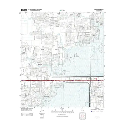
2013 Map of Addicks
USGS Topo · Published 2013About this map
Barker Reservoir dominates the southern landscape of this Harris County quadrangle, where the massive flood control structure intersects the headwaters of Buffalo Bayou. This 2013 survey illustrates the dense residential development that has defined the region, with established subdivisions such as Settlers Village, Bear Creek Plantation, and Yorktown Colony filling the spaces between the prairie creeks. The transport network is anchored by the Katy Fwy and Old Katy Rd, while the West Houston Airport provides a significant local aviation landmark. Amidst this modern suburban expansion, the Baker Cem remains as a tangible link to the area's earlier history. Drainage patterns are clearly visible through the winding courses of Langham Creek, Dinner Creek, and Mason Cr, which funnel toward the major reservoir system.
Find a feature on this map
56 named features on this map. Tap any name to fly to it.
Don’t see what you’re looking for? This feature index may not catch every label — zoom into the map to look around manually.
Map Details
Editions of this 2013 Addicks Map
This is the sole edition of this map. No revisions or reprints were ever made.
Other maps of this area

1915 · Alief
USGS Topo · 1:24,000

1915 · Cypress
USGS Topo · 1:24,000

1915 · Katy
USGS Topo · 1:24,000

1915 · Addicks
USGS Topo · 1:24,000

1915 · Hillendahl
USGS Topo · 1:24,000

1915 · Clodine
USGS Topo · 1:24,000

1916 · Satsuma
USGS Topo · 1:24,000

1916 · Swanson
USGS Topo · 1:24,000

1918 · Cypress
USGS Topo · 1:31,680

1918 · Addicks
USGS Topo · 1:31,680