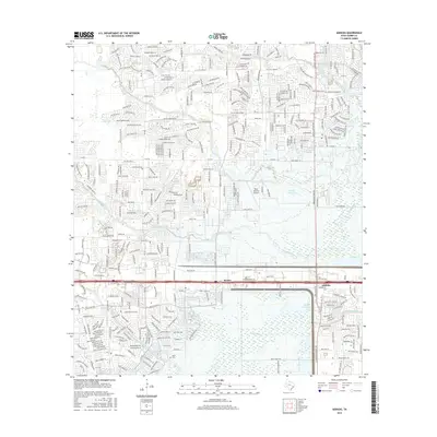
2016 Map of Addicks
USGS Topo · Published 2016About this map
The communities of Barker and Addicks sit at the center of a landscape defined by significant water management and suburban expansion in western Harris County. Large-scale hydrological features like the Addicks Reservoir and Barker Reservoir dominate the eastern and southern portions of the sheet, designed to control the flow of Buffalo Bayou and its many tributaries, including Bear Creek, Langham Cr, and South Maude Creek. These basins represent critical infrastructure protecting the region from the heavy rains typical of the Texas Gulf Coast.
Find a feature on this map
120 named features on this map. Tap any name to fly to it.
Don’t see what you’re looking for? This feature index may not catch every label — zoom into the map to look around manually.
Map Details
Editions of this 2016 Addicks Map
This is the sole edition of this map. No revisions or reprints were ever made.
Other maps of this area

1915 · Alief
USGS Topo · 1:24,000

1915 · Cypress
USGS Topo · 1:24,000

1915 · Katy
USGS Topo · 1:24,000

1915 · Addicks
USGS Topo · 1:24,000

1915 · Hillendahl
USGS Topo · 1:24,000

1915 · Clodine
USGS Topo · 1:24,000

1916 · Satsuma
USGS Topo · 1:24,000

1916 · Swanson
USGS Topo · 1:24,000

1918 · Cypress
USGS Topo · 1:31,680

1918 · Addicks
USGS Topo · 1:31,680