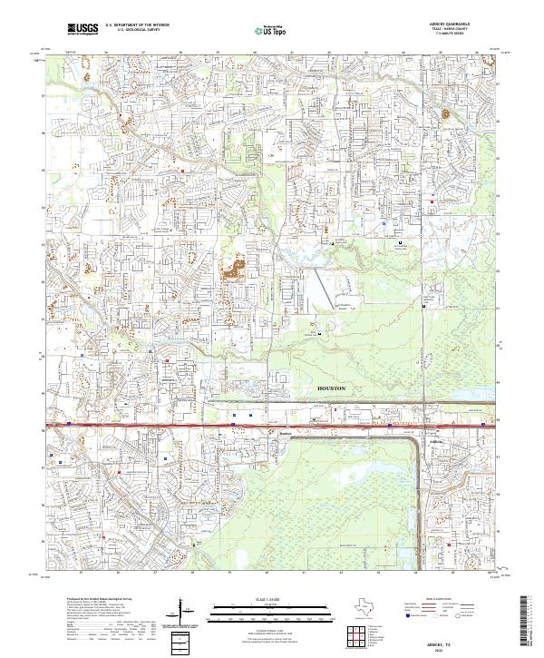
2022 Map of Addicks
USGS Topo · Published 2022About this map
Barker Reservoir dominates the landscape of this western Harris County study, serving as a critical piece of water management infrastructure where Buffalo Bayou meets several local tributaries. The map reveals a transition from the dense suburban expansion of Houston into specialized residential and industrial zones, punctuated by historical family landmarks. Several small burial grounds, including the Groschke Family Cem and the Koch-Schmidt Cem, are preserved amidst the modern grid of residential streets and schools like the Houston Community College Katy Campus. The network of watercourses, such as Bear Creek, Langham Creek, and Dinner Creek, illustrates the natural drainage patterns that have historically shaped development near the unincorporated communities of Barker and Addicks. This survey provides a precise look at the area's infrastructure, from the West Houston Airport to the intricate residential road networks that continue to expand west of the city center.
Find a feature on this map
85 named features on this map. Tap any name to fly to it.
Don’t see what you’re looking for? This feature index may not catch every label — zoom into the map to look around manually.
Map Details
Editions of this 2022 Addicks Map
This is the sole edition of this map. No revisions or reprints were ever made.
Other maps of this area

1915 · Alief
USGS Topo · 1:24,000

1915 · Cypress
USGS Topo · 1:24,000

1915 · Katy
USGS Topo · 1:24,000

1915 · Addicks
USGS Topo · 1:24,000

1915 · Hillendahl
USGS Topo · 1:24,000

1915 · Clodine
USGS Topo · 1:24,000

1916 · Satsuma
USGS Topo · 1:24,000

1916 · Swanson
USGS Topo · 1:24,000

1918 · Cypress
USGS Topo · 1:31,680

1918 · Addicks
USGS Topo · 1:31,680