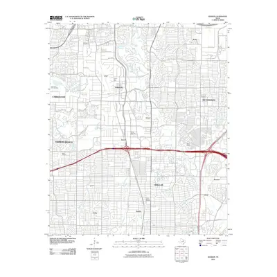
2010 Map of Addison
USGS Topo · Published 2010About this map
Addison and the surrounding north Dallas suburbs appear as a dense network of residential streets and commercial thoroughfares in this 2010 survey. The landscape is defined by its aviation and transit infrastructure, anchored by the Addison Airport and the intersection of the Dallas North Tollway with major arteries like Arapaho Rd and Alpha Rd. Despite the intensive modern development, fragments of the area's earlier rural character remain visible through family and community landmarks. Historical burial grounds such as White Rock Cemetery, Mount Calvary Cemetery, and Merrell Cemetery are preserved amidst the urban sprawl. Natural drainage patterns, including White Rock Creek and its tributaries like Bachman Branch and Cottonwood Creek, provide a winding contrast to the rigid grid of the surrounding neighborhoods in Carrollton, Richardson, and Farmers Branch.
Find a feature on this map
56 named features on this map. Tap any name to fly to it.
Don’t see what you’re looking for? This feature index may not catch every label — zoom into the map to look around manually.
Map Details
Editions of this 2010 Addison Map
This is the sole edition of this map. No revisions or reprints were ever made.
Other maps of this area

1891 · Dallas
USGS Topo · 1:125,000

1893 · Dallas
USGS Topo · 1:125,000

1925 · Mc Kinney 3-c
USGS Topo · 1:48,000

1925 · Dallas 2-b
USGS Topo · 1:48,000

1929 · Frisco
USGS Topo · 1:62,500

1929 · McKinney
USGS Topo · 1:62,500

1931 · Carrollton
USGS Topo · 1:62,500

1954 · Dallas
USGS Topo · 1:250,000

1954 · Sherman
USGS Topo · 1:250,000

1957 · White Rock Lake
USGS Topo · 1:24,000