2023 Map of Addison
USGS Topo · Published 2023About this map
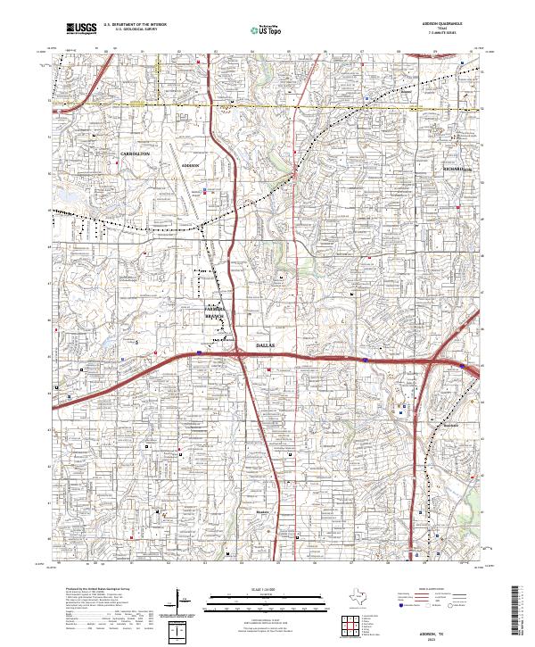
Addison and the northern suburban landscape of Dallas are defined here by a dense network of modern infrastructure and established neighborhoods. The sprawling grounds of the Addison Airport occupy the heart of the region, surrounded by corporate corridors and residential developments that cross the county lines between Denton Co and Dallas Co. Despite the heavy urban development, historical landmarks remain preserved throughout the area, including the Frankford Cem and Warner Cem. Local water systems like White Rock Creek and Farmers Branch provide natural breaks in the grid, while major transit arteries like the Lyndon B Johnson Fwy and Dallas Pkwy facilitate the intense connectivity of the North Dallas area. Pockets of institutional presence, such as Brookhaven College, stand alongside older settlement sites like Renner and Meaders, reflecting the rapid evolution from rural farming communities to a primary commercial and residential hub.
Find a feature on this map
43 named features on this map. Tap any name to fly to it.
Don’t see what you’re looking for? This feature index may not catch every label — zoom into the map to look around manually.
Map Details
Editions of this 2023 Addison Map
This is the sole edition of this map. No revisions or reprints were ever made.