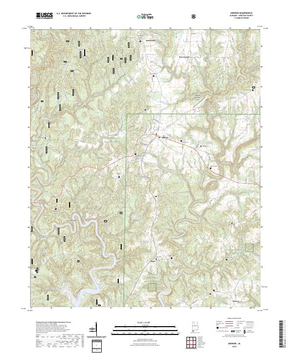
2024 Map of Addison
USGS Topo · Published 2024About this map
Addison sits at the heart of this landscape, serving as a hub for the small communities and family farmsteads that dot the southern reaches of the William B. Bankhead National Forest. This survey illustrates a settlement pattern deeply rooted in faith and family history, evidenced by a high density of rural burial grounds such as the Alston Family Cemetery, Hillcrest Cemetery, and the Old Houston Cemetery near Brushy Creek. The town's connectivity is defined by its position on Old US Highway 278 and the presence of the Addison Municipal Airport. Moving south toward Helicon and Eagle, the terrain is defined by the winding paths of Rock Creek and Inman Creek, which carve through the wooded landscape. The intersection of historic roads and isolated churches like the Fairview Missionary Baptist Church Number 2 highlights the enduring character of these Winston County communities.
Find a feature on this map
102 named features on this map. Tap any name to fly to it.
Don’t see what you’re looking for? This feature index may not catch every label — zoom into the map to look around manually.
Map Details
Editions of this 2024 Addison Map
This is the sole edition of this map. No revisions or reprints were ever made.
Other maps of this area

1935 · Upshaw
USGS Topo · 1:24,000

1935 · Danville
USGS Topo · 1:48,000

1936 · Mc Kendry
USGS Topo · 1:24,000

1936 · Moulton
USGS Topo · 1:48,000

1938 · Danville
USGS Topo · 1:62,500

1940 · Mt Hope
USGS Topo · 1:62,500

1956 · Gadsden
USGS Topo · 1:250,000

1958 · Gadsden
USGS Topo · 1:250,000

1960 · Gadsden
USGS Topo · 1:250,000
1960 · Grayson
USGS Topo · 1:24,000