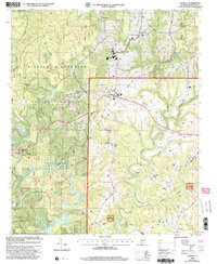
2000 Map of Addison
USGS Topo · Published 2003About this map
William B Bankhead National Forest defines the rugged landscape of this Winston County region, where the steep drainages of Brushy Creek and Blevens Creek cut through the forested plateau. The map captures a moment of modern transition as the northern fingers of Lewis Smith Lake reach into the southern terrain, flooding the lower reaches of Cow Creek and Brindley Creek. The town of Addison serves as the central hub, supported by surrounding rural settlements like Helicon and New Georgia. Genealogists and local historians will find significant value in the documentation of remote burial sites and meeting houses, such as Old Houston Cem, Fairview Cem, and Friendship Ch. The presence of an Airstrip and a designated High Sch in Addison indicates the area's development as a regional center amidst the protected wilderness of the Black Warrior Wildlife Management Area.
Find a feature on this map
33 named features on this map. Tap any name to fly to it.
Don’t see what you’re looking for? This feature index may not catch every label — zoom into the map to look around manually.
Map Details
Editions of this 2000 Addison Map
This is the sole edition of this map. No revisions or reprints were ever made.
Other maps of this area

1935 · Upshaw
USGS Topo · 1:24,000

1935 · Danville
USGS Topo · 1:48,000

1936 · Mc Kendry
USGS Topo · 1:24,000

1936 · Moulton
USGS Topo · 1:48,000

1938 · Danville
USGS Topo · 1:62,500

1940 · Mt Hope
USGS Topo · 1:62,500

1956 · Gadsden
USGS Topo · 1:250,000

1958 · Gadsden
USGS Topo · 1:250,000

1960 · Gadsden
USGS Topo · 1:250,000
1960 · Grayson
USGS Topo · 1:24,000