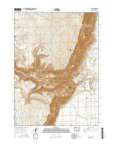
2017 Map of Adel
USGS Topo · Published 2017About this map
Adel serves as the primary settlement hub in this high-desert landscape, where the sharp verticality of Lynchs Rim and S Warner Rim transitions abruptly into the broad, wetland-rich floor of the Warner Valley. The geography is defined by its water management and geothermal features, notably the Crump Geyser and Crump Reservoir at the valley's edge. To the west, the terrain rises through the Sweeney Canyon and Gibson Canyon systems toward high plateaus like Squaw Flat. The map documents a sophisticated network of water resources vital for cattle ranching in the Great Basin, including the Crump Ditch, Pelican Lake, and several named livestock watering points such as Bug Waterhole and Sweeney Waterhole. Deep Creek Falls marks a significant hydrologic point where drainage from the uplands reaches the valley floor, feeding into the complex marsh system that characterizes the eastern half of the quadrangle.
Find a feature on this map
36 named features on this map. Tap any name to fly to it.
Don’t see what you’re looking for? This feature index may not catch every label — zoom into the map to look around manually.
Map Details
Editions of this 2017 Adel Map
This is the sole edition of this map. No revisions or reprints were ever made.
Other maps of this area

1955 · Klamath Falls
USGS Topo · 1:250,000

1955 · Adel
USGS Topo · 1:250,000

1957 · Adel
USGS Topo · 1:250,000

1958 · Klamath Falls
USGS Topo · 1:250,000

1958 · Adel
USGS Topo · 1:250,000

1962 · Adel
USGS Topo · 1:250,000

1967 · Priday Reservoir
USGS Topo · 1:24,000

1967 · Crump Lake
USGS Topo · 1:24,000
1968 · Sage Hen Butte
USGS Topo · 1:24,000
1968 · May Lake
USGS Topo · 1:24,000