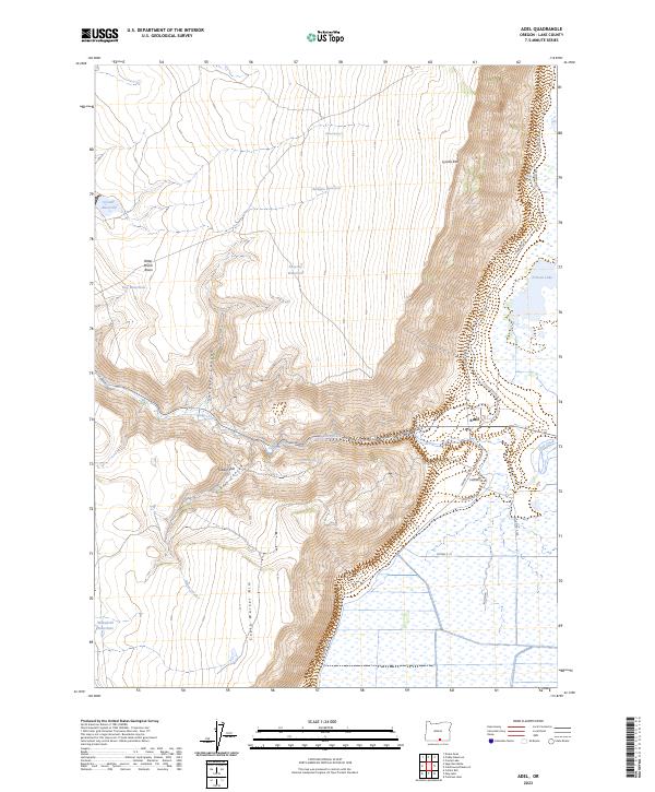
2023 Map of Adel
USGS Topo · Published 2023About this map
Adel sits at the base of the dramatic western escarpment of the Warner Valley, where the water from Deep Creek spills toward the valley floor. The geography here is defined by sharp elevation changes between the high plateaus of Lynchs Rim and South Warner Rim and the wetland-rich basin below. This landscape has long supported ranching through water management features like Crump Ditch and the Rodgers Reservoir, while natural wonders such as Crump Geyser and Deep Creek Falls highlight the region's active geothermal and hydraulic character.
Find a feature on this map
36 named features on this map. Tap any name to fly to it.
Don’t see what you’re looking for? This feature index may not catch every label — zoom into the map to look around manually.
Map Details
Editions of this 2023 Adel Map
This is the sole edition of this map. No revisions or reprints were ever made.
Other maps of this area

1955 · Klamath Falls
USGS Topo · 1:250,000

1955 · Adel
USGS Topo · 1:250,000

1957 · Adel
USGS Topo · 1:250,000

1958 · Klamath Falls
USGS Topo · 1:250,000

1958 · Adel
USGS Topo · 1:250,000

1962 · Adel
USGS Topo · 1:250,000

1967 · Priday Reservoir
USGS Topo · 1:24,000

1967 · Crump Lake
USGS Topo · 1:24,000
1968 · Sage Hen Butte
USGS Topo · 1:24,000
1968 · May Lake
USGS Topo · 1:24,000