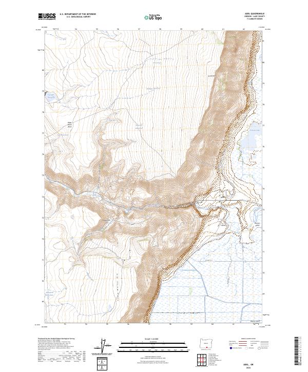
2024 Map of Adel
USGS Topo · Published 2024About this map
Adel sits at the base of the dramatic Lynchs Rim, where the high desert plateau drops sharply into the wetlands of the Warner Valley. This 2024 survey captures the complex water management systems of Lake County, where Crump Ditch and various reservoirs like Rodgers Reservoir and Crump Reservoir support life in an otherwise arid landscape. The topography is defined by significant elevation changes, from the heights of the South Warner Rim down through Sweeney Canyon and Gibson Canyon.
Find a feature on this map
37 named features on this map. Tap any name to fly to it.
Don’t see what you’re looking for? This feature index may not catch every label — zoom into the map to look around manually.
Map Details
Editions of this 2024 Adel Map
This is the sole edition of this map. No revisions or reprints were ever made.
Other maps of this area

1955 · Klamath Falls
USGS Topo · 1:250,000

1955 · Adel
USGS Topo · 1:250,000

1957 · Adel
USGS Topo · 1:250,000

1958 · Klamath Falls
USGS Topo · 1:250,000

1958 · Adel
USGS Topo · 1:250,000

1962 · Adel
USGS Topo · 1:250,000

1967 · Priday Reservoir
USGS Topo · 1:24,000

1967 · Crump Lake
USGS Topo · 1:24,000
1968 · Sage Hen Butte
USGS Topo · 1:24,000
1968 · May Lake
USGS Topo · 1:24,000