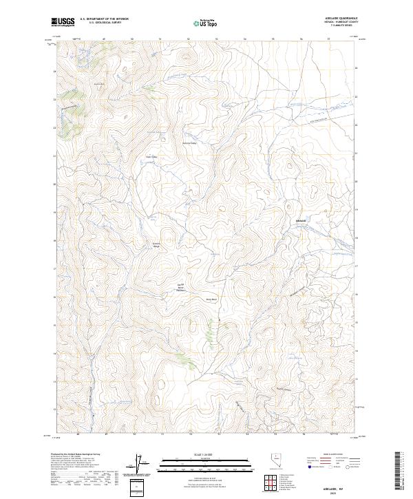
2023 Map of Adelaide
USGS Topo · Published 2023About this map
Adelaide sits at the eastern edge of the Sonoma Range in this modern topographic study of Humboldt County. The terrain is defined by extreme elevation changes, rising from Sonoma Valley and Clear Valley toward the heights of Sonoma Peak at the northwestern corner. The landscape is a network of named canyons and seasonal water sources, where springs like Reinhart Spring, Granite Spring, and Harry Kaul Spring suggest the critical importance of water management in this high-desert environment.
Find a feature on this map
38 named features on this map. Tap any name to fly to it.
Don’t see what you’re looking for? This feature index may not catch every label — zoom into the map to look around manually.
Map Details
Editions of this 2023 Adelaide Map
This is the sole edition of this map. No revisions or reprints were ever made.
Other maps of this area

1932 · Sonoma Range
USGS Topo · 1:250,000

1939 · Sonoma Range
USGS Topo · 1:250,000

1955 · Winnemucca
USGS Topo · 1:250,000

1958 · Winnemucca
USGS Topo · 1:250,000

1958 · Winnemucca
USGS Topo · 1:62,500

1961 · Leach Hot Springs
USGS Topo · 1:62,500

1962 · Winnemucca
USGS Topo · 1:250,000

1965 · Goldrun Creek
USGS Topo · 1:24,000
1965 · Golconda
USGS Topo · 1:24,000

1965 · Edna Mountain
USGS Topo · 1:62,500