
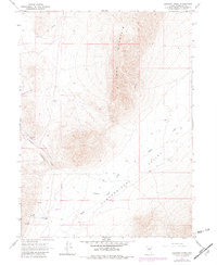
1965 Map of Goldrun Creek
USGS Topo · Published 1967About this map
Edna Mountain dominates this portion of the Nevada landscape, where the high ridges of the range overlook the wide expanse of Pumpernickel Valley to the southeast. The area's water sources, critical for both ranching and mining in this arid climate, are clearly marked, including the namesake Goldrun Creek and several hot springs. Evidence of the region’s mineral wealth is scattered throughout the terrain, most notably at the Adelaide Mine and various Prospects located near the mountainside.
Find a feature on this map
15 named features on this map. Tap any name to fly to it.
Don’t see what you’re looking for? This feature index may not catch every label — zoom into the map to look around manually.
Map Details
Editions of this 1965 Goldrun Creek Map
2 editions found
Other maps of this area

1932 · Sonoma Range
USGS Topo · 1:250,000

1939 · Sonoma Range
USGS Topo · 1:250,000

1955 · Winnemucca
USGS Topo · 1:250,000

1958 · Winnemucca
USGS Topo · 1:250,000

1958 · Winnemucca
USGS Topo · 1:62,500

1961 · Leach Hot Springs
USGS Topo · 1:62,500

1962 · Winnemucca
USGS Topo · 1:250,000
1965 · Golconda
USGS Topo · 1:24,000

1965 · Edna Mountain
USGS Topo · 1:62,500
1965 · Brooks Spring
USGS Topo · 1:24,000