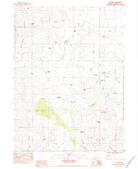
1983 Map of Adelaide
USGS Topo · Published 1983About this map
Adelaide and its surrounding mining history define this high-elevation landscape in the early 1980s. The settlement is centered near the Adelaide Crown Mines and a mill site, reflecting a period of active or legacy resource extraction along the eastern slopes. Higher elevations are dominated by the Sonoma Range and Sonoma Peak, where the terrain transitions into complex drainages such as Goldrun Creek and Robber Creek. Evidence of grazing and local land use is scattered throughout the canyons and flats, indicated by features like Sibbald Corral, Rock Creek Ranch, and the George Baine Meadows. A network of 4WD tracks and a pipeline trace the utilitarian infrastructure of the Great Basin, connecting remote water sources like Reinhart Spring and Cumberland Spring to the lower basins. The map illustrates the functional relationship between the high peaks and the mining claims that drove the local economy.
Find a feature on this map
39 named features on this map. Tap any name to fly to it.
Don’t see what you’re looking for? This feature index may not catch every label — zoom into the map to look around manually.
Map Details
Editions of this 1983 Adelaide Map
This is the sole edition of this map. No revisions or reprints were ever made.
Other maps of this area

1932 · Sonoma Range
USGS Topo · 1:250,000

1939 · Sonoma Range
USGS Topo · 1:250,000

1955 · Winnemucca
USGS Topo · 1:250,000

1958 · Winnemucca
USGS Topo · 1:250,000

1958 · Winnemucca
USGS Topo · 1:62,500

1961 · Leach Hot Springs
USGS Topo · 1:62,500

1962 · Winnemucca
USGS Topo · 1:250,000

1965 · Goldrun Creek
USGS Topo · 1:24,000
1965 · Golconda
USGS Topo · 1:24,000

1965 · Edna Mountain
USGS Topo · 1:62,500