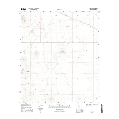
2017 Map of Aden Crater
USGS Topo · Published 2017About this map
Aden Crater dominates the central landscape of this Doña Ana County survey, a testament to the volcanic history that shaped this part of the Chihuahuan Desert. The map captures a largely arid expanse defined by ranching infrastructure and localized topography, notably Headquarters Hill to the northwest. Unlike more densely populated regions, human presence here is primarily indicated by a network of cattle tanks, such as Sue Anne Tank and John Tank New Tank, which are vital for supporting livestock in this environment.
Find a feature on this map
17 named features on this map. Tap any name to fly to it.
Don’t see what you’re looking for? This feature index may not catch every label — zoom into the map to look around manually.
Map Details
Editions of this 2017 Aden Crater Map
This is the sole edition of this map. No revisions or reprints were ever made.
Other maps of this area

1891 · Las Cruces
USGS Topo · 1:125,000

1893 · Las Cruces
USGS Topo · 1:125,000

1917 · Noria
USGS Topo · 1:62,500

1917 · Mt. Riley
USGS Topo · 1:62,500

1918 · Mt. Riley
USGS Topo · 1:62,500

1918 · Noria
USGS Topo · 1:62,500

1929 · Mt. Riley
USGS Topo · 1:62,500

1941 · Aden
USGS Topo · 1:62,500

1943 · Aden
USGS Topo · 1:62,500

1943 · Afton
USGS Topo · 1:62,500