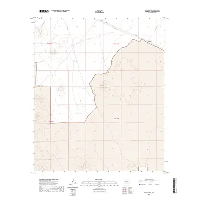
2023 Map of Aden Crater
USGS Topo · Published 2023About this map
Aden Crater dominates this volcanic landscape in Doña Ana County, a stark geomorphic feature surrounded by high desert terrain and sparse infrastructure. The northern portion of the map traces a corridor of human activity where Co RD b004 and Co RD b002 pass through the small locales of Pronto and Kenzin, providing vital connectivity across the basin. The reliance on managed water in this arid environment is evident through several named catchments, including Sue Anne Tank, John Tank, and Brock Tank, which are scattered throughout the sections. To the northwest, Headquarters Hill rises as a prominent landmark near the intersection of several county routes, while the township and range lines of t25s r3w, t25s r2w, t26s r3w, and t26s r2w establish the legal grid over this largely open territory.
Find a feature on this map
17 named features on this map. Tap any name to fly to it.
Don’t see what you’re looking for? This feature index may not catch every label — zoom into the map to look around manually.
Map Details
Editions of this 2023 Aden Crater Map
This is the sole edition of this map. No revisions or reprints were ever made.
Other maps of this area

1891 · Las Cruces
USGS Topo · 1:125,000

1893 · Las Cruces
USGS Topo · 1:125,000

1917 · Noria
USGS Topo · 1:62,500

1917 · Mt. Riley
USGS Topo · 1:62,500

1918 · Mt. Riley
USGS Topo · 1:62,500

1918 · Noria
USGS Topo · 1:62,500

1929 · Mt. Riley
USGS Topo · 1:62,500

1941 · Aden
USGS Topo · 1:62,500

1943 · Aden
USGS Topo · 1:62,500

1943 · Afton
USGS Topo · 1:62,500