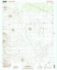
1996 Map of Aden Crater
USGS Topo · Published 2001About this map
Aden Crater Volcano and the extensive lava flows of The Malpais dominate this high-desert landscape in southern New Mexico. This 1996 photoinspection reveals a terrain defined by volcanic activity and the critical infrastructure required for ranching in an arid environment. A network of water catchments, including Johnson Tank, Brock Tank, and Sue Ann Tank, are distributed across the basin to support livestock, while Headquarters Hill stands as a prominent landmark in the northwestern quadrant.
Find a feature on this map
10 named features on this map. Tap any name to fly to it.
Don’t see what you’re looking for? This feature index may not catch every label — zoom into the map to look around manually.
Map Details
Editions of this 1996 Aden Crater Map
This is the sole edition of this map. No revisions or reprints were ever made.
Other maps of this area

1891 · Las Cruces
USGS Topo · 1:125,000

1893 · Las Cruces
USGS Topo · 1:125,000

1917 · Noria
USGS Topo · 1:62,500

1917 · Mt. Riley
USGS Topo · 1:62,500

1918 · Mt. Riley
USGS Topo · 1:62,500

1918 · Noria
USGS Topo · 1:62,500

1929 · Mt. Riley
USGS Topo · 1:62,500

1941 · Aden
USGS Topo · 1:62,500

1943 · Aden
USGS Topo · 1:62,500

1943 · Afton
USGS Topo · 1:62,500