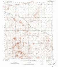
1941 Map of Aden
USGS Topo · Published 1984About this map
The Southern Pacific R R cuts a diagonal path through this arid basin of Doña Ana County, anchoring the small settlements of Aden and Kenzin during the early 1940s. The landscape is defined by volcanic features and high-desert flats, most notably the Aden Crater and the eastern fringes of the West Potrillo Mountains. The map reveals a remote ranching and industrial presence, evidenced by the Strauss Ranch Headquarters and the Brass Ranch, alongside a scattered network of water infrastructure like Aden Wells and Johns Tank that supported the local economy.
Find a feature on this map
24 named features on this map. Tap any name to fly to it.
Don’t see what you’re looking for? This feature index may not catch every label — zoom into the map to look around manually.
Map Details
Editions of this 1941 Aden Map
2 editions found
Other maps of this area

1891 · Las Cruces
USGS Topo · 1:125,000

1893 · Las Cruces
USGS Topo · 1:125,000

1917 · Camel Mountain
USGS Topo · 1:62,500

1917 · Noria
USGS Topo · 1:62,500

1917 · Mt. Riley
USGS Topo · 1:62,500

1918 · Mt. Riley
USGS Topo · 1:62,500

1918 · Noria
USGS Topo · 1:62,500

1929 · Mt. Riley
USGS Topo · 1:62,500

1941 · Las Cruces
USGS Topo · 1:62,500

1941 · Aden
USGS Topo · 1:62,500